Factsheet from Icelandic Met Office 4. September
Scientists from the Icelandic Met Office and the Institute of Earth Sciences and representatives of the Civil Protection in Iceland attend the meetings of the Scientific Advisory Board of the Icelandic Civil Protection.
Conclusions of the Scientific Advisory Board of the Icelandic Civil Protection:
- The intensity of the ongoing eruption in Holuhraun is not declining. Lava is flowing toward ENE and it has been elongated considerably since yesterday. Since this morning, a preliminary estimate of lava field extension is about 10.8 km2.
- Seismic activity is still detected in the northern part of the dyke intrusion, along the eruption site and extending south below Dyngjujökull. Event rates are lower than in recent days, 180 earthquakes have been detected since midnight until noon. Four events larger than M4 have been detected in Bárðarbunga caldera. The largest one (M4.8) occurred last night at 03:09.
- The low frequency tremor seen yesterday disappeared last night but started again this morning, however minor compared to yesterday. The source of the tremor is not certain however possible explanation could be magma-water interaction although this interpretation has currently not been confirmed by other observations.
- There are no signs of a subglacial eruption under Dyngjujökull. No obvious changes such as increased water flow or cauldrons on the glacier surface were observed from scientists on board TF-SIF yesterday. Water meters in Jökulsá á Fjöllum do not show any unusual changes in discharge and electric conductivity.
- The GPS time series indicate slower rate of deformation in the last 24 hours. The current deformation pattern north of Vatnajökull still suggests volume increase in the dyke. No significant signs of deformation are observed around Bárðarbunga.
- There have been no observations of ash-fall away from the eruption site. Ash production is negligible.
- Sulphur dioxide emission continues. Low-wind speed condition is present in the area at the moment. Based on radar images the eruption cloud from today (composed of steam and volcanic gases) has not drifted far away and is mostly concentrated around the eruption site. Stations measuring SO2 further away from the eruption site are showing concentration below health and safety thresholds. Since this morning, the cloud reaches 6 km of altitude. The volcanic cloud will drift towards south in the coming hours due to wind rotation.
- Four scenarios are likely:
o The migration of magma could stop, resulting in a gradual reduction in seismic activity and no further eruptions.
o The dike could reach the Earth’s surface causing another eruption, possibly on a new fissure. Lava flow and (or) explosive activity cannot be excluded.
o The intrusion reaches the surface and another eruption occurs where either the fissure is partly or entirely beneath Dyngjujökull. This would most likely produce a flood in Jökulsá á Fjöllum and perhaps explosive, ash-producing activity.
o An eruption in Bárðarbunga. The eruption could cause an outburst flood and possibly an explosive, ash-producing activity. In the event of a subglacial eruption, it is most likely that flooding would affect Jökulsá á Fjöllum. However it is not possible to exclude the following flood paths: Skjálfandafljót, Kaldakvísl, Skaftá and Grímsvötn.
Other scenarios cannot be excluded.
From the Icelandic Met Office:
The Aviation Colour Code for Bárðarbunga remains at ‘orange’ and the code for Askja at ‘yellow’.
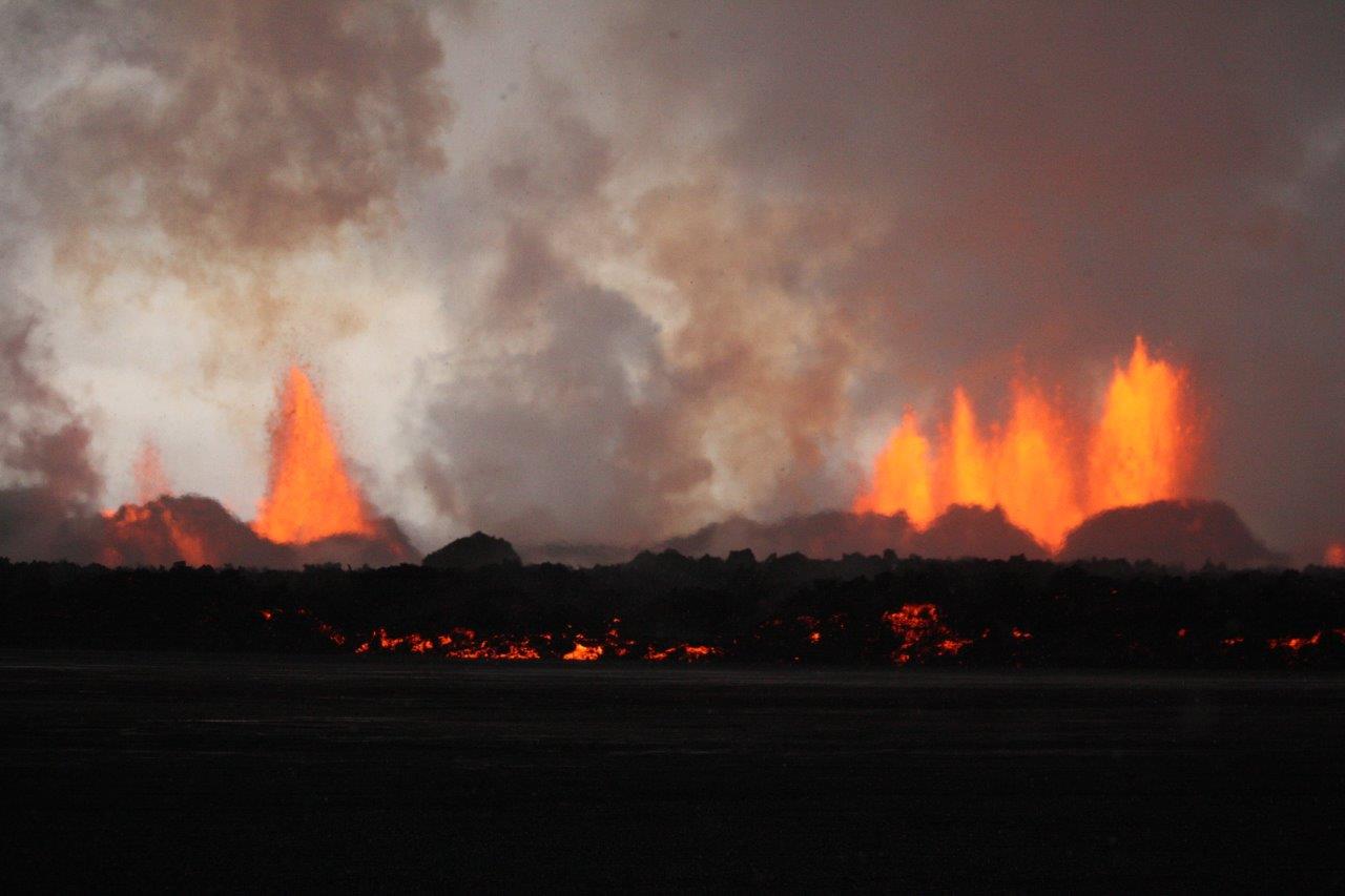
Picture Ármann Höskuldsson.
