Pictures and posters showing the development in Holuhraun
Here are three posters from the scientists at Institute of Earth Sciences University of Iceland and the Icelandic Met Office.
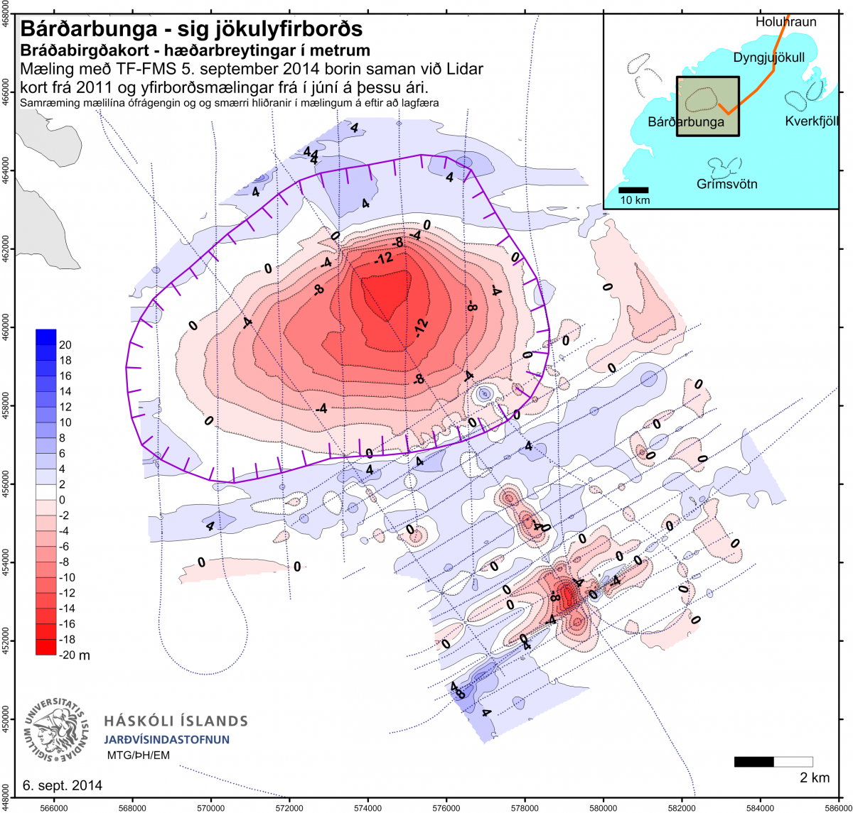
Subsidence in the Bárðarbunga caldera. Map by Institute of Earth Sciences University of Iceland.
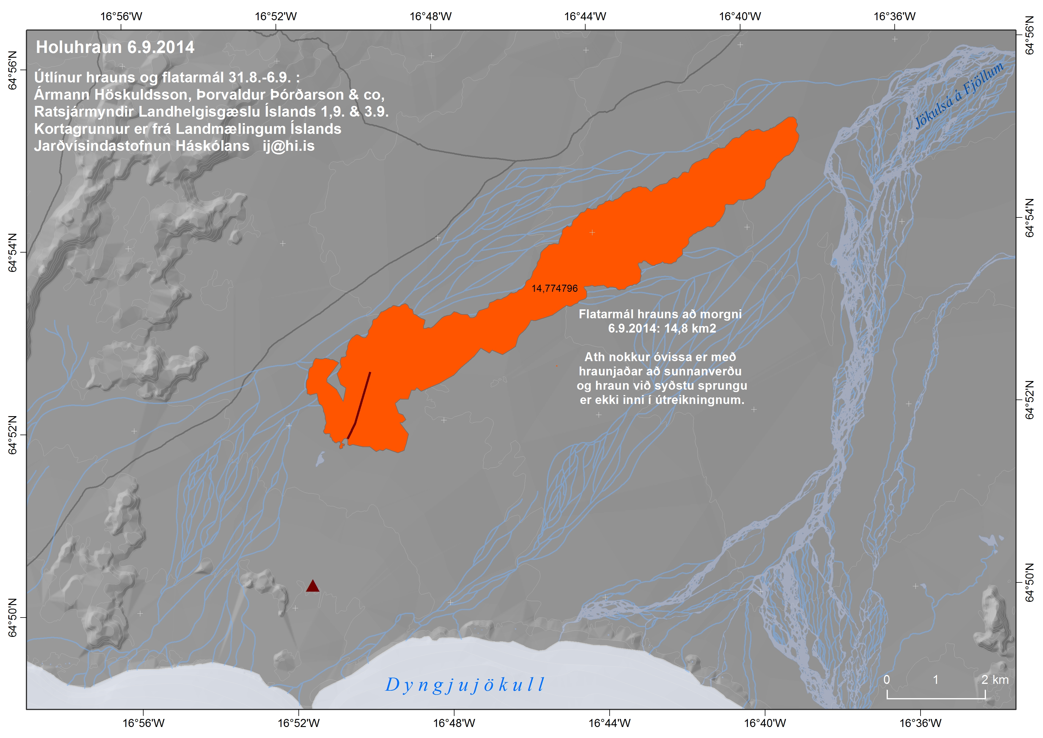
The lava from the eruption in Holuhraun. Map by Institute of Earth Sciences University of Iceland.
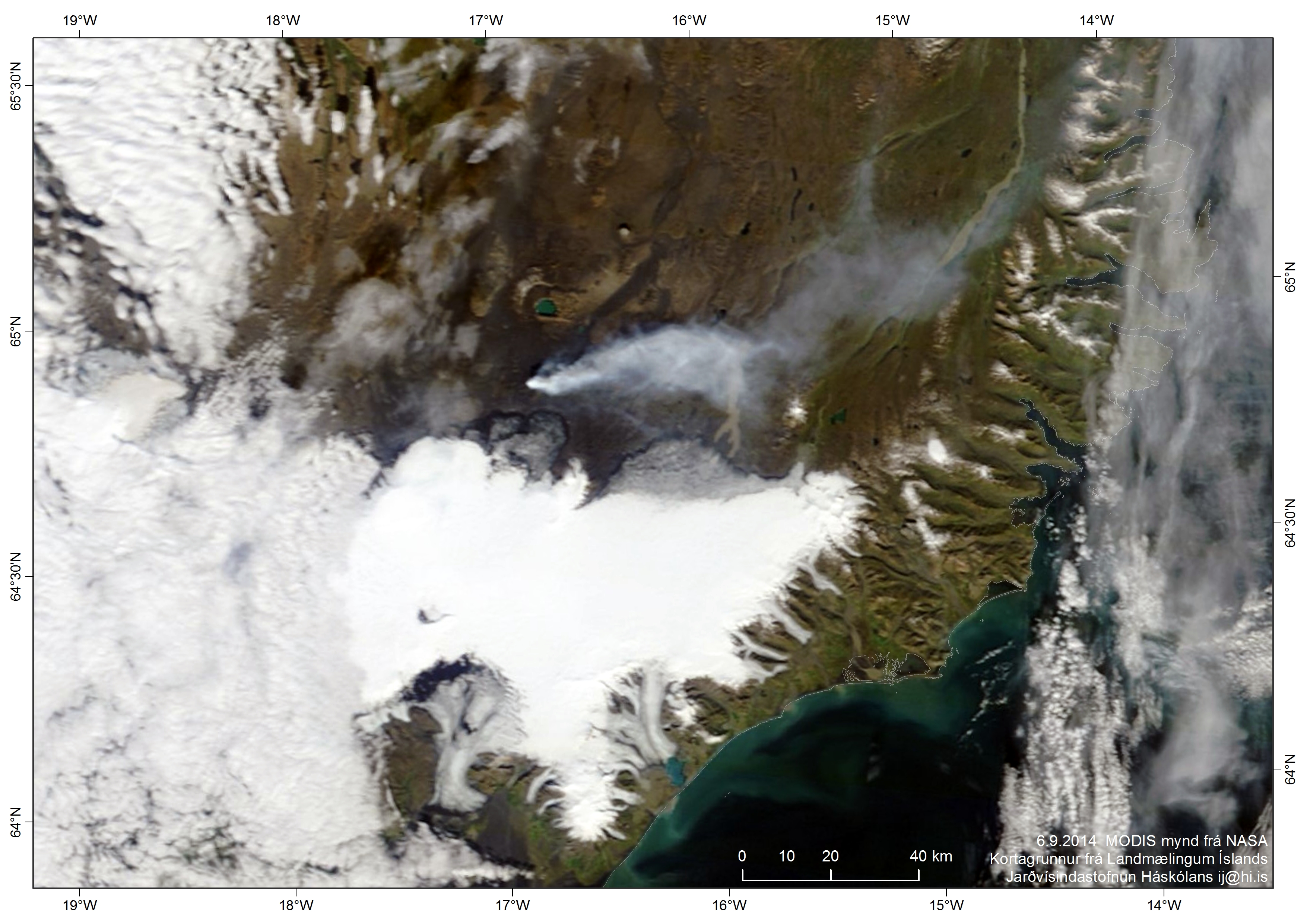
The plume from the eruption in Holuhraun as seen by NASA. Picture from Icelandic Met Office.
